HURRICANE HUNTERS

  • HOME
  • Cyberflight
    > Eye-to-Eye
  • Data
  • Events & PA
  • Gallery
  • Jobs
  • History
  • Stories
  • Background
  • FAQs
  • Ask Us
  • Links

  • Daniel
  • Beryl
  • Eye to Eye with Tropical Depression #4

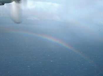
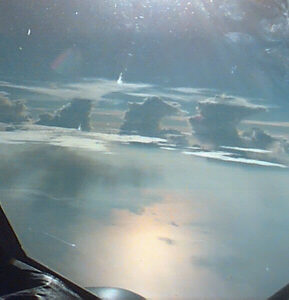
    rainbow in the mist A brilliant rainbow paced alongside our WC-130 as we sliced through the mist. Rainshowers dotted the seascape as we investigated a small tropical depression off the Atlantic coast of Florida in early August. This storm formed about 400 miles east of Florida on Aug 8th, and came within 70 miles of Cape Canaveral before it turned away and dissipated on the 11th.

    Our flights into developing tropical cyclones are flown very low, sometimes as low as 500 feet above the sea surface. On this flight, we found a sharp, 7-millibar drop in pressure at the center, where the winds crisply changed direction--a clearly defined tropical cyclone.

    Aug 9, 2000

    pilot
      changing frequencies
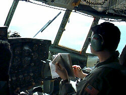
    Tropical sunshine floods the flight deck, turning it into a sauna. We'll drink a lot of water on this flight to stay hydrated. In the hot seat, Aircraft Commander Mark guards the throttles, ready to respond in an instant if we encounter a sudden windshear from the showers and thunderstorms which tower around the plane.
      At the same time, Copilot John (an airline pilot in his civilian career) makes a radio call to the Air Traffic Controllers, to reassure them we're still safe n' sound.
    scanner window view
      yellow line is the radar sweep
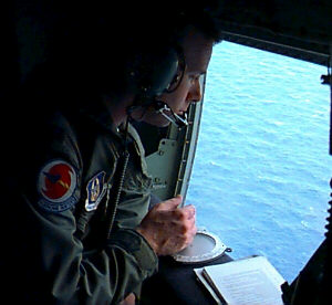
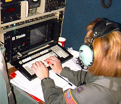
    Weather officer Eric picks off wind direction and speed by spotting wave crests and patches of sea foam as the ocean rolls rapidly under the aircraft. This is an exciting part-time job for our reservists; Eric is one of three National Weather Service meteorologists flying with our squadron, bringing a wealth of experience and knowledge.
      While most of our weather data are collected by onboard computers, we also use our eyes to describe the size and shape of the storm on radar. A dim orange band of showers curved around the center of the storm, as seen in this dark photo of our radar (looks much better in real life...)
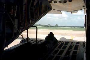
    Six crewmembers work as a team on these flights. Dropsonde operator Ed has a dual role of a "loadmaster", keeping a watchful eye on all the aircraft systems in the main part of the plane (cargo compartment). He also talks the pilot through the backing of the plane when we are leaving our parking spot (right).
      C-130 backs under its own power
    Aug 10, 2000

    This was a double tasking day... our crew surveyed two different storms on one flight. We started in a tropical wave to the east of TD#4, and then flew through TD#4 on the way home.
      friendly skies
    Flight Engineer Gary has one of the best seats in the house, in the center of the flight deck. From this perch, he surveys all the engine instruments and the health of the plane, and keeps track of how much fuel we have left on these long missions.
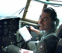
      Copilot Bob obviously enjoys his work, and judging from our e-mail, a lot of you wish you could be out there with us, too! But we're glad you decided to join us here for a trip in cyberspace.
    data sent instantly to NHC
      thin white patches
are altostratus clouds
    Flight meteorologist Michelle mapped out the winds around the tropical wave, and determined the winds were not blowing in a counterclockwise circle near the surface. Not a tropical depression! We finished with was our third and final survey of TD#4.
      The worst weather we saw all day was on our return to Mississippi. A line of thunderstorms menaced all along the coast, which we dodged on our way home.

    We flew TD #1 in June, and then TD #4 in August... where were TD's #2 and #3? Well, we never flew TD #2; it was a short-lived tropical depression in the eastern Atlantic, which dissipated by the time it hit the mid-Atlantic--too far away for us to fly. Then TD #3 formed on the 3rd of August, and became "Alberto" the next day, eventually becoming a major hurricane--and also the longest-lived hurricane ever to form in August (20 days as a named storm). However, Alberto never posed a threat to land, so we did not fly this storm. See NHC's August Summary for more about these storms.
    Go to Beryl or 2000 Summary or Home Page